")
")
")
")
Description
ENTRE EM UMA NOVA GERAÇÃO DE AVIÔNICOS, MAIS RÁPIDOS E MAIS INTELIGENTES
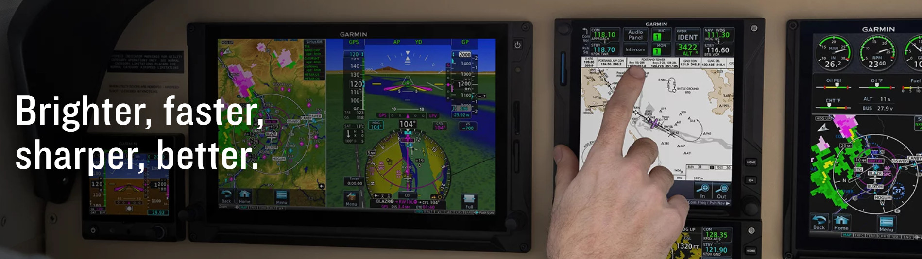
Com mais pixels, mais poder de processamento, mais velocidade e desempenho, nosso sistema GTN 750Xi traz novas capacidades de crescimento para a principal plataforma GPS/Nav/Comm/MFD do setor.
![]()
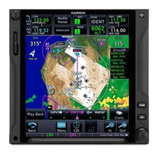
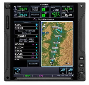
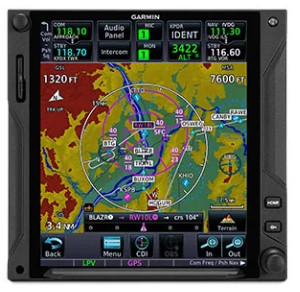
Visualize todo o seu plano de voo, incluindo esperas e aproximações em uma grande tela sensível ao toque de 6,9”.
![]()
Mais rápido é melhor. Processadores de alta velocidade reduzem o tempo de inicialização em 50% em relação aos modelos GTN anteriores.
![]()
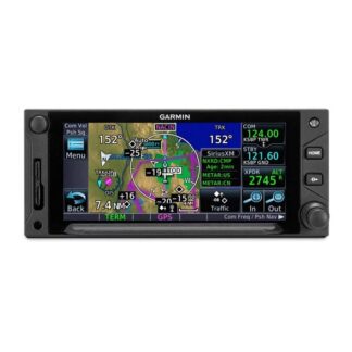
Voe nas aproximações que desejar — desde aproximações visuais até LPV, RNAV, ILS e muito mais.
![]()
É de fácil interface com uma ampla gama de aviônicos, pilotos automáticos e displays de voo existentes1.
![]()
Carregue planos de voo e atualizações de banco de dados sem fio com um link Connext® opcional.
![]()
Atualizar? A nova série GTN Xi oferece atualização fácil para aviônicos GTN existentes.
SEE THE FULL PICTURE
Graphical routing on the display lets you visualize your entire flight plan, including departures, arrivals, visual/instrument approaches, holding procedures and more.
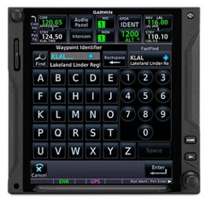
FAST FIND
As soon as you start typing, the GTN Xi FastFind feature uses quick predictive logic to suggest airport and waypoint entries by using current GPS position. Just select and go.
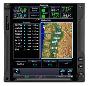
AIRWAYS, YOUR WAY
Victor airways and high-altitude jet routes can be overlaid on the map. For easy IFR routings, view airway segments available from a waypoint and corresponding exit options.
“RUBBER BAND” REROUTES
This handy feature lets you grab a flight plan leg on the screen, and then stretch or move it to adjust for a deviation or ATC amendment to your flight plan.
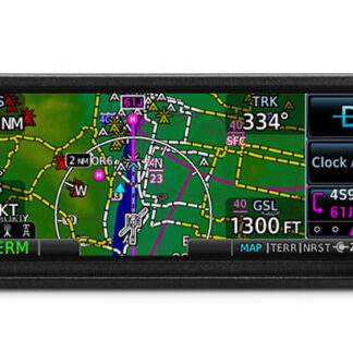
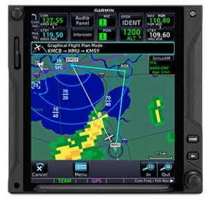
VIRTUAL MAP TOPOGRAPHY
By referencing built-in terrain, mapping and obstacles databases, GTN 750Xi shows detailed surface features, cities, airports, SUAs and more on the dynamic map display.
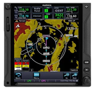
TERRAIN ALERTING
A built-in database provides color-coded display overlays to warn when potential terrain conflicts loom ahead. Class A or B TAWS alerting is optionally available.
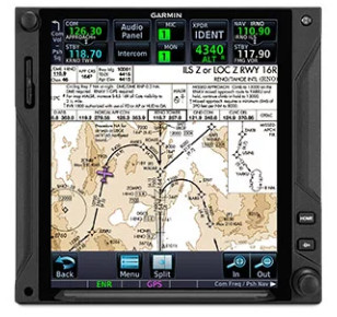
VIEW CHARTS IN CONTEXT
Garmin’s standard FliteCharts® or optional Jeppesen® style ChartView™ plates provide georeferenced approaches and terminal procedures.
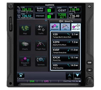
DIRECT CONNECT
A Direct-to key on the bezel lets you quickly enter a direct course for any selected waypoint. A menu of nearest airports and flight plan waypoints makes for easy entry.
Encontre mais informações sobre o sistema no site da Garmin clicando aqui.
Para ver imagens de aeronaves modificadas pela JAZZ que receberam o GTN750Xi, veja a nossa galeria clicando abaixo.